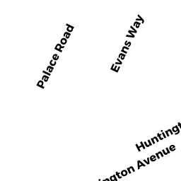
600R HUNTINGTON AV
Owner Information
COMMONWEALTH OF MASS ACTING
ONE ASHBURTON PL 15TH FL
BOSTON, MA 02108


Property Details
600R HUNTINGTON AV is classified as a Improved, Tax Title/Treasurer (Dormitory bd).
The primary structure on this property was built in 2001. There are 290,000ft2 of built area within this property. There is 290,000ft2 of residential/living space within this property.
600R HUNTINGTON AV is valued at $60,944,500. The land is valued at $26,790,100 and the structures are valued at $33,895,800. There is an additional valuation of $258,600 on this property.
The most recent deed for 600R HUNTINGTON AV is recorded at the local registrar in Book 50915, Page 218. 600R HUNTINGTON AV was last sold on Friday, February 1, 2013 for $9.
Assessment data from fiscal year 2020.
Flood Data
According to the FEMA National Flood Hazard Layer, this property does not appear to be in a flood zone. It may also be in an area not yet reviewed. Nonetheless, confirm this information prior to taking any action.
To view the flood hazards around this property, create a FEMA "Firmette" Map of the area around 600R HUNTINGTON AV.
Broadband Internet Providers
| Provider | Type | Bandwidth (mbps) | |
|---|---|---|---|
| Crown Castle Fiber | Fiber | 0 | 0 |
| Viasat Inc | Satellite | 100 | 3 |
| Verizon New England Inc. | DSL | 15 | 1 |
| Verizon New England Inc. | Fiber | 940 | 880 |
| Comcast | Cable | 1000 | 35 |
| RCN | Cable | 500 | 20 |
| Starry, Inc. | Fixed Wireless | 200 | 200 |
| netBlazr Inc | Fixed Wireless | 50 | 50 |
| PAETEC Communications, Inc | DSL | 0 | 0 |
| GCI Communication Corp. | Satellite | 0 | 0 |
| HughesNet | Satellite | 25 | 3 |
| VSAT Systems, LLC. | Satellite | 2 | 1 |
Broadband service provider data from December 2020.